


|
Background
In 2011 Gorrenberry was a 935 hectare hill farm including four dwellings and two groups of steadings on the Hermitage Water, Roxburghshire, Scottish Borders (55.266827N, 2.845836W). It was purchased in March 2011 by Jane Bower and Ken Lyall. The farm is approximately 20 miles south of Hawick and is reached by the unclassified road between the A7 and the B6399 signposted to Hermitage Castle. The land at the time of purchase was mainly steep hills with about 70 hectares of improved pasture (fig 1). The hills had been heavily grazed, probably for centuries, and at the time of purchase there were about 1400 Southern Cheviot sheep and fifty five store cattle on the land. There were three small stands of conifers planted between 1950-60. In 2008 181 hectares of further plantings, 107 of conifers, mainly sitka spruce and 74 hectares of native broadleaves, had been undertaken by the previous owner funded by a Scottish Rural Development Priorities(SRDP) grant. These plantings had suffered considerable browsing damage and about half of the trees were lost by 2011. In that year weeding and maintenance work was carried out on the remaining trees and in 2012 the lost trees were replaced.
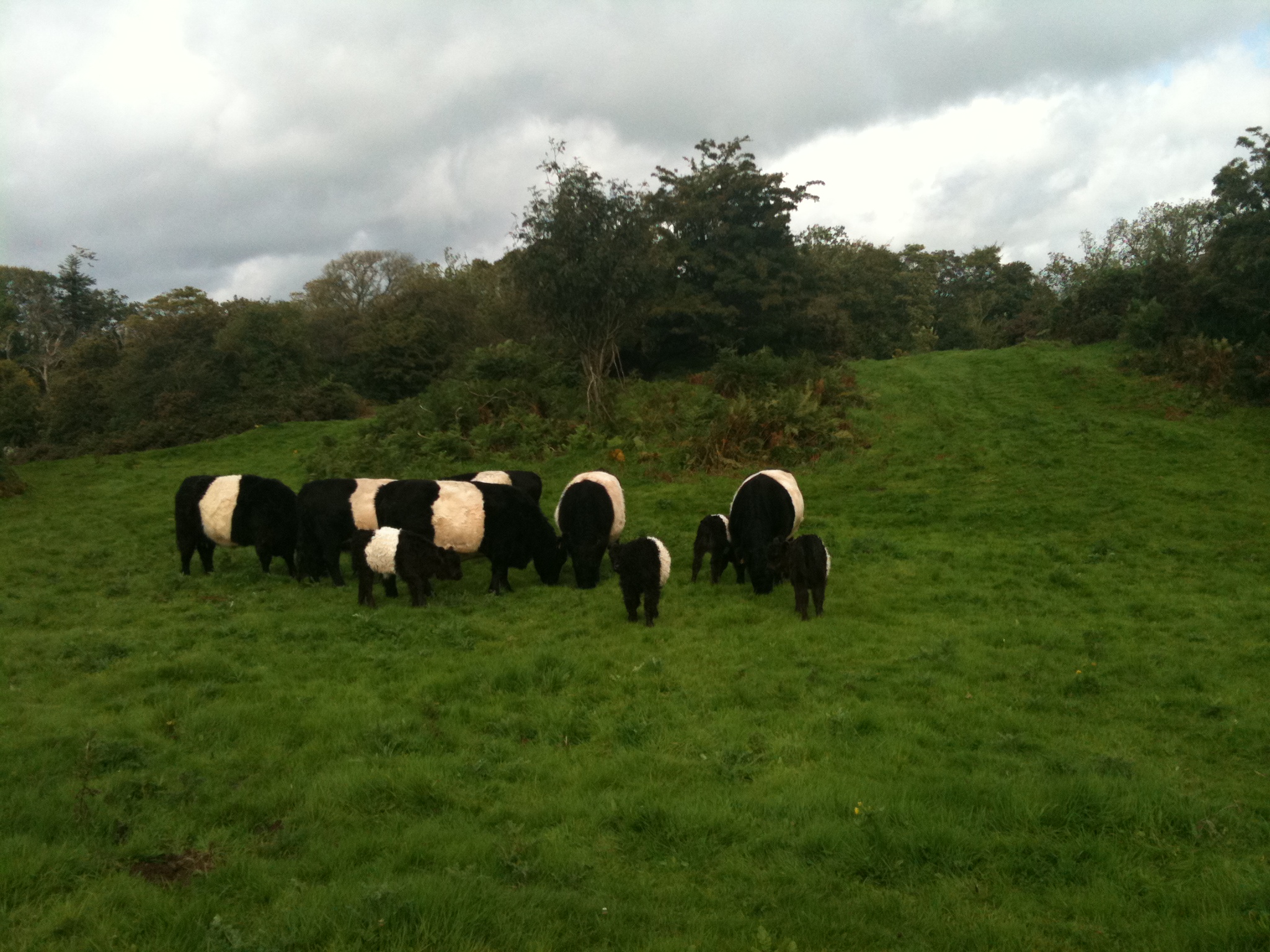
Since this 366 hectare planting was to be carried out during the Diamond Jubilee Year of Her Majesty Queen Elizabeth II an application was made for it to be recorded as a Jubilee Wood. The application was accepted for entry in the Royal Record and, since this was such a large planting, it was additionally designated one of 25 Princess Woods, each representing a year of the Queen's life before she came to the throne. It was decided to start a small herd of Belted Galloway cattle which would co-graze the inbye land with Southern Cheviot sheep at a sustainable level. Two cows with calves and two heifers were acquired in the spring of 2012 and a bull was borrowed for the season from the Park herd. The Landscape
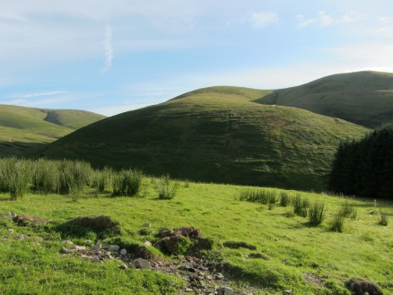
The Land As noted above the land in 2011 consisted of 70 hectares of semi-improved inbye land and 865 hectares of rough hill grazing rising from 220 m to 640m at the highest point. None of the ground was under cultivation, although there were abundant signs of earlier cultivation including what is believed to have been a mediaeval village at Billhope. The east/west Scottish watershed runs along the western boundary of the ground and a number of burns run down through the farm to the Hermitage Water, of which the largest are the Gorrenberry Burn and the Billhope Burn which both form substantial valleys.
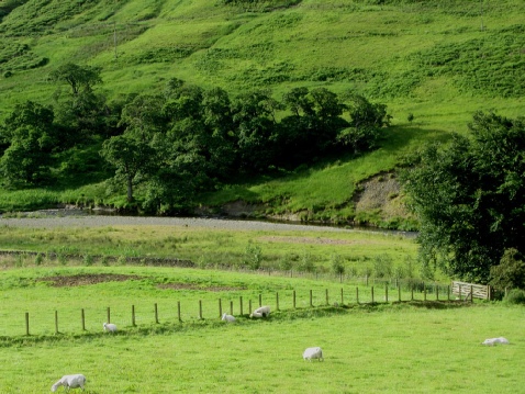
The Hermitage Water which bounds much of the southern edge of the estate is a salmon river
and the fish have historically spawned in the river and its tributary burns. The success of
salmon, trout and sea trout breeding here has diminished seriously in recent years. The
English Environmental Agency is responsible for the river and burns which are part of the
Esk catchment which drains to the Solway. They surmise that the problem may be in the
main due to the very heavy rainfalls in winter, which scour the spawning grounds. The
Billhope Burn is reported to rise by 4-5 feet after these storms. A report (Acreman, M., 1991,
Scottish Geographical Journal, 107(3), 170-8) recorded the damage done in 1983 by a
Most of the farm had been heavily grazed for many, probably hundreds, possibly even thousands of years. There were few mature trees in 2011 apart from the three small strips of conifers near the main steadings and a small strip of ancient woodland, mainly alder, hazel and ash, along the Hermitage Water at the south-westerly edge of the farm. An occasional hawthorn, birch or willow was all that was left of what must once have been extensive woods, plus a small number of sycamore and beech near the rivers. The hillsides are steep and the ground showed many signs of erosion. However there were some relics of native woodland flora including two hillsides covered with bluebells beside the Billhope Burn. The Buildings At the time of purchase there were four dwellings on the farm which belonged to the farm, Gorrenberry House, Gorrenberry Cottage, Old Gorrenberry Cottage and Old Billhope Cottage. Gorrenberry House was the farmhouse and the others were rented out. Old Gorrenberry Cottage, the oldest dwelling, was a Bastle house, a fortified farmhouse, probably built in the 18 th Century near the site of Gorrenberry Tower, a peel tower which has completely vanished. The only remaining architectural features of interest in Old Gorrenberry were the roof timbers which were hand-hewn, possibly, ash, held together by wooden dowels, and some of beams supporting the floor of the first floor, which were also hand-hewn, some still partly covered in bark .The other houses were 18-19 th Century constructions. There were two groups of farm buildings. One was a traditional range built during the 18 th and 19 th centuries behind Gorrenberry House, most of which was in a poor state of repair. The other was a group of steadings erected since World War II beside Old Gorrenberry Cottage which was in a variable state of repair. A further house, Billhope Cottage, was surrounded by the farm but belonged to a neighbouring farming family and was not part of the purchase. The Wildlife in 2011 The lack of trees and overgrazing had inevitably reduced the diversity of wildlife on the farm. There were at least 20 roe deer, several badger setts, a pair of otters, many foxes, some rabbits and hares in 2011. Red squirrels could be spotted from time to time in the ancient woodland along the Hermitage Water at the south east corner of the farm. Bird life was varied on the farm but not numerous.The farm lies across the river from Langholm Moor, site of the Langholm Moor project which aimed to encourage nesting hen harriers to co-exist with a commercial grouse moor. Birds of conservation importance at Gorrenberry included skylarks, golden plovers and a few pairs of red grouse but no black grouse were reported in 2011. Several pairs of buzzards nested in the adjacent plantations and hunted over the farm. A number of other raptor species were sighted. The farm buildings and houses hosted many swallows and house martins in the summer. A barn owl had nested for some years in one of the traditional barns, and there were bats, probably pipistrelles, in the summer. Vegetation 2011 On the ridge tops blanket bog and modified blanket bog were present. The commonest community on the hillsides was unimproved acid grasslands, with patches of base-rich grassland occurring around base-rich flushes. The lower slopes were dominated by semi- improved grassland with some marshy grassland. Archaeology It is not possible to exclude the possibility that circular enclosures and what may be the remains of hut platforms are of prehistoric date. Placenames of p-celtic derivation suggest early habitation. However most features and structures identified in the archaeology survey were of mediaeval or later period. History Gorrenberry Tower was a tower house at 55.266827N, 2.845836W. No structural remains can now be seen but there was reported to be a slight rectangular mound, about 11.0m E-W by 4.5m (www.scotlandsplaces.gov.uk). It may have been there in 1320 when folklore says that the Lord de Soulis of Hermitage Castle took a fancy to Fair May of Goranberry, the sweetheart of the heir to Branxholm, a member of the Scott family (John Leyden's Border Ballads - "Lord de Soulis"; www.borderreivers.co.uk). Scions of the Elliots and the Scotts lived at various times here. The estate was until the 1970s part of the Buccleuch Estates. 1732 - Goranberry is marked on H. Moll's 1732 map (http://maps.nls.uk/view/?id=216) in Liddesdale, with its northern march on the boundary with Roxburghshire. 1832 - It is also shown on John Thomson's Atlas of Scotland, 1832, as Gorronberry or Gorrenberry (http://maps.nls.uk/atlas/thomson/view/? ) in Castletown Parish. 1912 - Bartholomew Survey Atlas of Scotland, 1912 shows Gorrenberry. (http://maps.nls.uk/atlas/bartholomew/view/?id=1165 The Brownie of Goranberry was reputed to live in the tower with one of the Elliots. Local place names are mainly anglo-saxon in origin with some Scandinavian influences - Langholm - and Brythonic (p-celtic) . The latter particularly at higher altitudes and in the remoter river valleys. Some Gorrenberry names may be of p-celtic origin e.g. Pennygant Hill - pen-y-cant - hill at the edge of the cul de sac.; Dinley - dun - a fort (B. Fox in www.heroicage.org/issues/10/fox.html ) ley - wooded place. No suggestions of the origin of the name Gorrenberry - could it be a Scandinavian name - Goran's Burgh? Purchasers' objective The purchasers' objective was to establish a pattern of ecological restoration activity and land management which would eventually create an area of rich biological diversity with a self- sustaining rural business at its heart. The initial plan was to :
1. Remove the sheep from the hill ground (completed 2011) Project monitoring It was planned to publish a summary of the baseline record and subsequent monitoring on this site. Annual photography from the same set of sites was to be undertaken to create a visual record of the growing woodland. Gorrenberry 2017 Visitors are welcome provided they observe the Countryside Access Code. They should bear in mind the need for stout, waterproof footwear and weatherproof clothing. It is better to avoid the higher areas when it is foggy or there is heavy cloud. Signs have been erected by the roadside indicating routes into Gorrenberry Jubilee Wood, and map boards have been set up in the woodland areas showing tracks over the hills which are suitable for walkers. Where the tracks go through fields with stock, walkers are advised to keep dogs on leads and avoid cattle. All gates should be left as found, whether open or closed. The woodland The rest of the woodland was planted in 2013 according to the plan submitted to the Forestry Commission. Each year the areas planted under the 2008 and 2012 contracts have undergone maintenance. With permission from the Forestry Commission the areas covered with bluebells had the sitka spruce saplings removed and Quercus petraea planted instead. A significant proportion of the earlier planting had to be replaced due to browsing damage, and each year there has been a fair amount of replacement of young trees in several areas due to vole damage. The vole population has been very abundant during this period. Replanted trees have been protected with vole guards. The roe deer population, which was substantial, has been reduced to a low level with the help of a grant to manage browsing. On one occasion several sheep from the other side of the hills came over and did a fair amount of damage before they were removed. The trees are establishing everywhere, but the speed of establishment and rates of growth are very variable with the sheltered valleys doing very well, and high exposed areas growing more slowly and with a bushier habit. The sitka spruce planted in 2008 are not doing well in a number of sites. The Forestry Commission has suggested that where they have left gaps in areas with suitable soil conditions, it would be acceptable to replace them with oak saplings. At present the conditions of the 2008 contract do not allow the sitka spruce to be removed, but in due course it is planned that they should be thinned out to provide "nurse" areas for broadleaves. Several small stands of native aspen have been planted by the roadside, in memory of family members who died in the Great War. These stands have been registered with the Woodland Trust. The Wildlife in 2017 The roe deer population is being rigorously controlled while the trees are vulnerable to browsing. Badgers, foxes, hares, rabbits, stoats and weasels are commonly spotted, as well as the abundant voles. Sadly, red squirrels have not been spotted since 2014, and occasional greys have been seen. A variety of raptors breed in the valleys and the small bird populations have grown rapidly. The increasing cover provided by the trees, and the increasing food supplies since the sheep were taken off the land have allowed the bird population to explode. Likewise the butterflies. All the common species are plentiful, and in 2016 the first blue butterfly was spotted, presumably thanks to the environment of the "limy cleuchs". The vegetation in 2017 When the sheep were taken off the vegetation immediately began to recover. This has provided food for the growing invertebrate and vertebrate populations. The profusion of wild flowers throughout the growing season supports a huge population of pollinating insects including several species of wild bees. On the other hand, the growth of tall grasses and bracken has competed with and overshadowed the young trees necessitating an active weeding programme.
The herd of belted Galloway cattle is now well-established. The beef from the herd is of outstanding quality. It is marketed through "Going Native", the butcher in the Sandbed, Hawick.
|
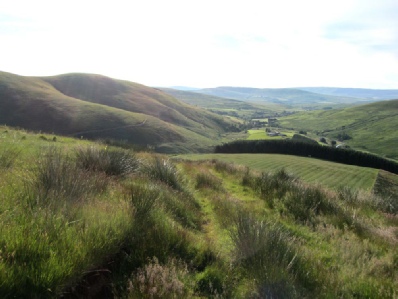 Gorrenberry is an ecological restoration project which aims to restore much of the
biodiversity of a substantial area in the Scottish Southern Uplands, while maintaining a
varied pattern of economic activity at a sustainable level.
 I
In March 2012 an application prepared with the help of UPM Tilhill was approved by the
Forestry Commission for an SRDP grant to plant a further 366 hectares with native
broadleaves. Martin Craig of UPM Tilhill was the project manager responsible for preparing
the grant application, assisted by colleagues including Forest Ecologist John Gallacher and
Lindsay Greer, forester. The application's forestry outcome plan was supported by an
archaeology survey, landscape appraisal, breeding bird survey, otter survey, vegetation and
peat depth survey, ecological site classification, and an assessment of the impact on the hen
harriers on the neighbouring Langholm Moor. The plan would leave the deep peat, marshy
areas and space around badger setts unplanted, as required by environmental regulations, and
allow sensitive landscaping of the plantings. After this planting only the 70 hectares of inbye
land would be available for grazing. UPM Tilhill began implementation of the project
immediately and planted the first 60 hectares during the spring of 2012.
I
In March 2012 an application prepared with the help of UPM Tilhill was approved by the
Forestry Commission for an SRDP grant to plant a further 366 hectares with native
broadleaves. Martin Craig of UPM Tilhill was the project manager responsible for preparing
the grant application, assisted by colleagues including Forest Ecologist John Gallacher and
Lindsay Greer, forester. The application's forestry outcome plan was supported by an
archaeology survey, landscape appraisal, breeding bird survey, otter survey, vegetation and
peat depth survey, ecological site classification, and an assessment of the impact on the hen
harriers on the neighbouring Langholm Moor. The plan would leave the deep peat, marshy
areas and space around badger setts unplanted, as required by environmental regulations, and
allow sensitive landscaping of the plantings. After this planting only the 70 hectares of inbye
land would be available for grazing. UPM Tilhill began implementation of the project
immediately and planted the first 60 hectares during the spring of 2012.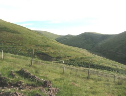 Gorrenberry is situated in Liddesdale in the "Southern Uplands with scattered forest"
Landscape character area in a hill range dominated by Pennygant, Tudhope, Crossbow Hill
and Cauldcleuch Head. Distinctly rounded hills are dissected by steep gullies with fast-
flowing watercourses. The surface geology is greywacke shales, with occasional "limy
cleuchs" indicating limestone intrusions.
 "tsunami" from this burn after an unusually heavy local storm. Other contributory factors to
the contemporary lack of salmon and sea trout include periodic deposition of silt in lower
reaches of the river system when clear felling of conifer plantations takes place. The silt has
been shown to suppress the invertebrate population on which the fish feed.
 Gorrenberry Belties